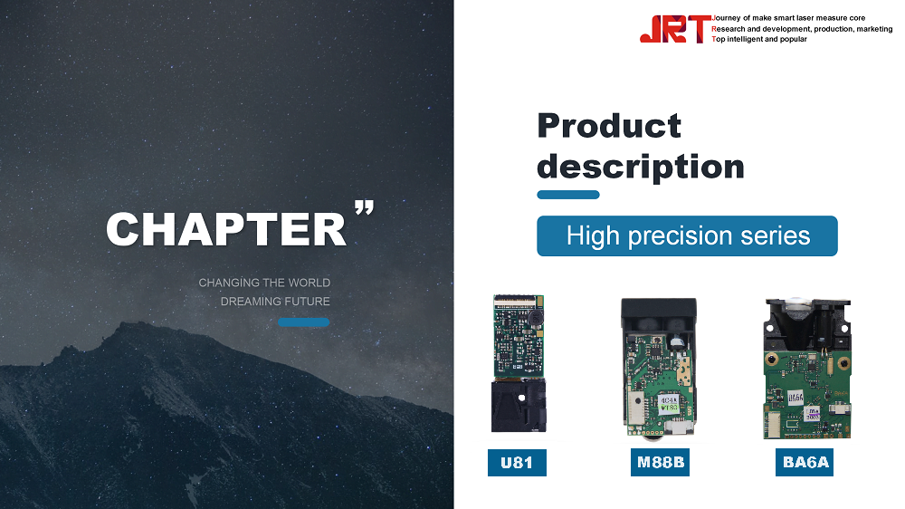
The advancement of LiDAR technology has revolutionized the way data is collected and analyzed across various industries, and the introduction of the new 1535nm LiDAR sensor marks a significant milestone in this evolution. With an impressive range of 3000 meters and a compact design optimized for drone integration, these sensors enhance capabilities in mapping, surveying, and environmental monitoring. By providing unparalleled accuracy and efficiency, the 1535nm LiDAR sensors are set to transform the aerial data acquisition landscape, enabling professionals to achieve more precise results in less time. This article will explore the key features, applications, and future implications of this innovative technology in the realm of drone usage.
Overview of 1535nm LiDAR Technology
What is 1535nm LiDAR?
1535nm LiDAR is a type of Light Detection and Ranging technology that uses light in the 1535 nanometer wavelength to measure distances. This cutting-edge tool sends out laser beams, which bounce off objects and return to the range finders sensor, allowing it to create highly accurate 3D maps. Think of it as a super-fancy tape measure, but with lasers—because who doesn’t want a little sci-fi in their life?
How it Differs from Other LiDAR Wavelengths
Unlike its cousins in the LiDAR family, which might operate at 905nm or 1064nm, the 1535nm wavelength offers specific advantages. It penetrates atmospheric conditions better, making it especially effective in bad weather or when scanning through foliage. It’s like the cool kid at the party who isn’t bothered by the rain—just keeps on mapping!
Key Features of the New 3000m Laser Range Sensors
Measurement Accuracy and Precision
With a range of up to 3000 meters, these sensors deliver top-notch precision that’ll have surveyors and engineers singing their praises. The accuracy is so impressive, you might even want to start measuring your living room just for fun. Who needs a level when you’ve got LiDAR?
Real-Time Data Processing Capabilities
Gone are the days of waiting for data to be processed. The new sensors provide real-time analytics, allowing users to make immediate decisions based on what the drone sees. It’s like having a personal assistant who always has your back, but without the coffee runs—unless that’s your thing, in which case, we respect your choices.
Durability and Environmental Resistance
These sensors are built tough. Designed to withstand harsh environments, they’re resistant to water, dust, and even the occasional accidental bump. It’s like they’ve been in training for a mud run—ready to tackle anything nature throws their way while keeping the laser light show going strong!

Advantages of Compact Design in Drones
Weight Reduction and Enhanced Flight Time
The compact design means lighter drones which can stay airborne longer without needing a caffeine boost. With less weight to carry around, these drones can maximize their flight time, allowing for extended mapping or surveying missions. More time in the air means more data collected—what's not to love?
Improved Maneuverability in Complex Environments
A smaller frame means a nimble drone that can weave in and out of tight spaces. Whether you’re flying through dense forests or crowded urban areas, these compact drones can navigate just about anywhere, making them the ultimate aerial acrobats. It’s like a superhero in the drone world—watch out, bad data!
Ease of Transportation and Deployment
No one wants to lug around heavy equipment. The compact design makes these drones easy to transport, so you can quickly deploy them wherever they’re needed. Toss it in the back of your car and hit the road—your LiDAR adventure awaits without the hassle of wrestling with bulky gear.
Applications of 1535nm LiDAR in Various Industries
Topographic Mapping and Surveying
1535nm LiDAR technology is a game changer for topographic mapping and surveying. Its accuracy in capturing terrain shapes and elevation data helps geologists, architects, and city planners make informed decisions. It’s like having a superpower that reveals the earth’s secrets!
Infrastructure Inspection and Monitoring
With its real-time data capabilities, 1535nm LiDAR makes inspecting bridges, roads, and buildings more efficient than ever. Engineers can quickly identify potential issues before they become disasters. Think of it as having a crystal ball that helps you stay one step ahead of structural woes.
Environmental and Agricultural Assessments
From monitoring forest health to evaluating crop conditions, the applications of 1535nm LiDAR in environmental and agricultural assessments are vast. Farmers and environmental scientists can now gather precise data to make better decisions for conservation and yield improvement. It's like having a green thumb with a laser focus!
Performance Comparison with Previous LiDAR Models
Range and Detection Capabilities
The new 1535nm LiDAR showcases a remarkable leap in range and detection capabilities compared to its predecessors. Offering a compact range of up to 3000 meters, this model allows for more extensive scanning of landscapes without the need for constant repositioning of the drone. The enhanced sensitivity means that it can detect objects even in challenging environments, like dense foliage or urban settings, improving overall data collection accuracy and detail.
Cost Efficiency and ROI Analysis
When it comes to the dollars and cents of drone operations, the 1535nm LiDAR doesn’t just play ball; it hits home runs. Its improved efficiency translates to quicker surveys and faster data processing, ultimately reducing operational costs. The upfront investment may seem hefty, but with increased productivity and the potential for capturing more detailed insights, the ROI becomes as sweet as a slice of cherry pie. Think of it this way: a well-placed penny saves a lot of time, and time is money!
Integration with Existing Drone Systems
Compatibility with Various Drone Platforms
One of the standout features of the new LiDAR model is its remarkable compatibility with various drone platforms. Whether you're flying with a DJI or a more niche brand, this sensor is like that friend who gets along with everyone at the party. This versatility allows businesses to leverage their existing drone fleets without needing to invest in brand-new equipment.
Software and Data Management Solutions
No need to panic; integrating this LiDAR with your software isn’t rocket science! Most established data management solutions readily embrace the new sensor, making data processing and analytics smoother than a jazz saxophonist on a Saturday night. From data acquisition to post-processing, users can expect an intuitive experience that turns complex datasets into user-friendly insights, ready for actionable strategies.
Future Trends in LiDAR Sensor Technology
Advancements in Sensor Technology
The future of LiDAR technology is as bright as a freshly polished mirror. With ongoing advancements, we can expect sensors that are not only more compact but also lighter and more efficient. Innovations in materials and design will pave the way for even cheaper production costs while enhancing performance, making LiDAR accessible for everyone from hobbyists to big corporations.
Integration with AI and Machine Learning
Imagine your LiDAR not just capturing data but also analyzing it like a seasoned analyst. The integration of AI and machine learning into LiDAR technology is the next big thing. Expect sensors that autonomously identify features, detect anomalies, and even predict trends. It’s like having a personal assistant that’s an expert in spatial data—minus the coffee breaks!
Potential Market Growth and Demand
As industries increasingly recognize the value of accurate terrain and environmental data, the market for LiDAR technology is poised for an explosion. With applications ranging from agriculture to construction and environmental monitoring, demand will soar higher than a drone caught in an updraft. Buckle up, because this ride into the future of LiDAR is just getting started!
Conclusion and Implications for Drone Usage
Summary of Key Benefits
To sum it up in one clear sentence: the new 1535nm LiDAR is a game-changer for drones, delivering unparalleled range, enhanced detection, and cost-efficient operations. With its easy integration into existing systems and the promise of future tech advancements, it becomes an indispensable tool for a variety of industries.
Future Outlook for LiDAR in Drones
Looking ahead, the future of LiDAR in drones is as promising as a dog at a park full of squirrels. As technology continues to evolve, we can anticipate greater accessibility, refined data collection capabilities, and wider applications. Bucking trends and pushing boundaries are what this tech does best, making it clear that LiDAR is here to stay and will only get better with time.In conclusion, the new 1535nm LiDAR sensors represent a significant advancement in aerial data collection, offering enhanced range, accuracy, and compactness ideal for drone applications. As industries continue to embrace this technology, the potential for improved efficiency and effectiveness in various fields is immense. By integrating these innovative sensors into their operations, professionals can harness the power of cutting-edge LiDAR technology to drive better outcomes and shape the future of data-driven decision-making.
Frequently Asked Questions
What industries can benefit from the new 1535nm LiDAR sensors?
The 1535nm LiDAR sensors can benefit various industries, including surveying, agriculture, environmental monitoring, urban planning, and infrastructure inspection. Their high accuracy and extended range make them suitable for a wide range of applications.
How do the 1535nm LiDAR sensors compare to traditional LiDAR systems?
The 1535nm LiDAR sensors offer several advantages over traditional systems, including improved range of up to 3000 meters, better accuracy, and a more compact design that enhances drone maneuverability and deployment.
Are the 1535nm LiDAR sensors compatible with existing drone platforms?
Yes, the new 1535nm LiDAR sensors are designed for compatibility with various drone platforms, allowing for easy integration and utilization with existing aerial systems.
What are the key benefits of using a compact LiDAR sensor in drones?
The compact design of LiDAR sensors in drones leads to reduced weight, improved flight time, enhanced maneuverability in difficult terrains, and easier transport and deployment, making them more efficient for fieldwork.
Chengdu JRT Main Ranging Modules: Industrial Laser Distance Sensors, Outdoor Rangefinder Laser Module, Tof LiDAR Sensors, New Arrivals Laser Rangefinder Module.